Jefferson River Canoe Trail Maps
Featuring Conservation, Recreation, and Lewis & Clark History
About our Maps
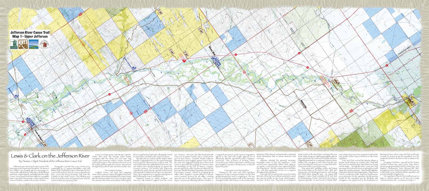
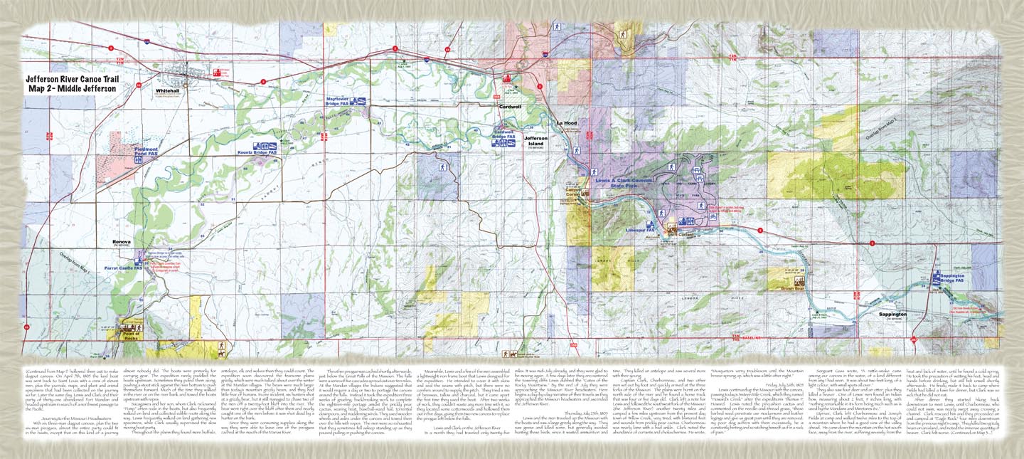
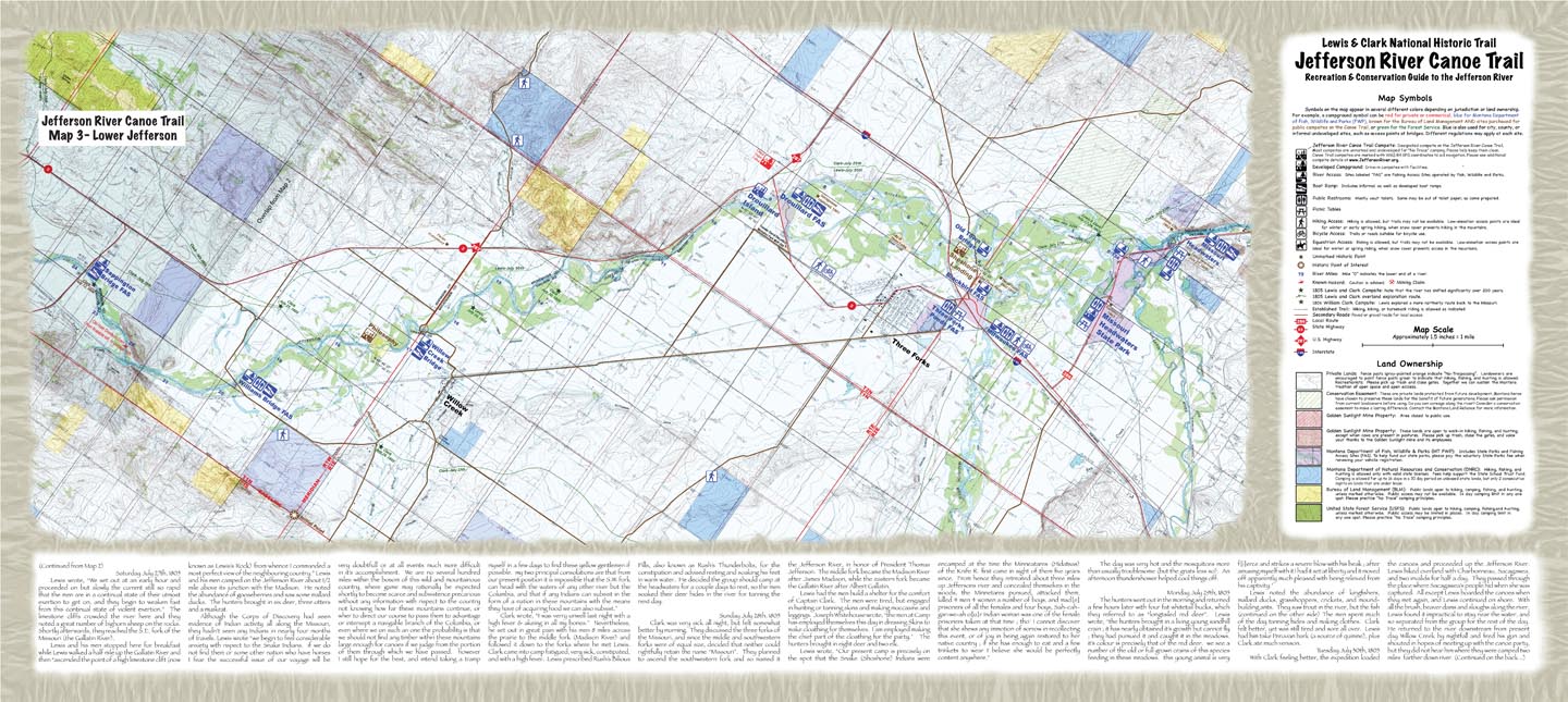
The Jefferson River Canoe Trail has produced a set of maps featuring conservation, recreation, and Lewis and Clark history along the Jefferson River.
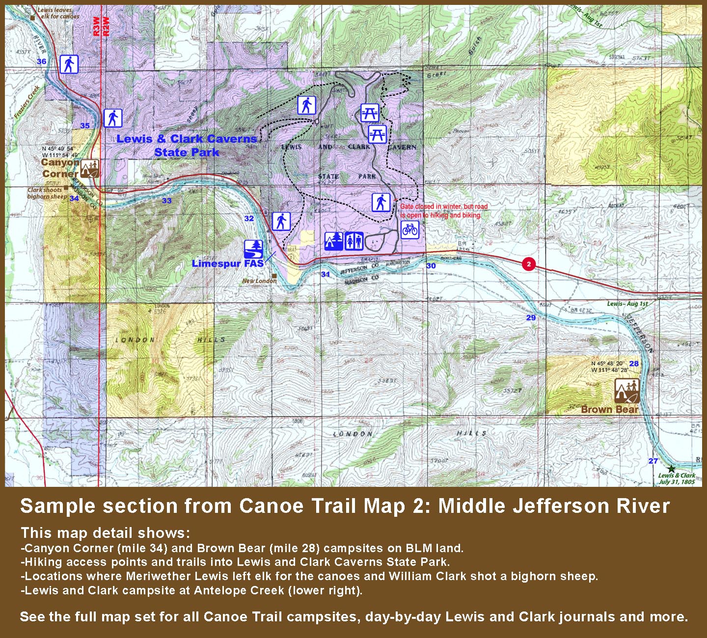
For recreationists, the Canoe Trail maps feature detailed information about the river course, access points, camping areas, and potential hazards. Text on the back of the maps also includes tips for being properly prepared, reminders to bring extra bags to pick up trash, guidelines for no-trace camping, and an overview of Montana's Stream Access Law.
The Canoe Trail Maps also feature a conservation message encouraging people to think about the cumulative effects of population growth in the area. Conservation easements are highlighted on the maps to show which lands have been protected from future development. Text on the back of the maps includes suggestions for living along the Jefferson without destroying it, including guidelines for building new houses.
The maps also include a detailed history of Lewis and Clark's experiences along the Jefferson River. Lewis and Clark campsites are marked on the maps, as well as their approximate overland routes as they took turns walking ahead of the canoes. Highlights of the Lewis and Clark story are included in a narrative, along with detailed journals of their day-by-day experiences along the Jefferson River.
For a printed copy of the maps, please order via PayPal below or send $4 for postage plus a suggested donation of $20 or more to the Jefferson River Canoe Trail - PO Box 697 - Pony, MT 59747.
Printing History
1st Edition: August 2007: Five hundred copies of the Jefferson River Canoe Trail Maps were printed at a cost of $5,335. Nearly half of the cost ($2,500) was paid for by a Cost Share Challenge grant from the National Park Service through the Lewis & Clark National Historic Trail. An additional $1,200 was paid by Jefferson County through the Metal Mines grant program. HOPS Press, LLC of Pony, Montana contributed $800 to the printing, while the balance was covered by the Jefferson River Canoe Trail.
Updated 2nd Edition: February 2016: Five hundred maps were printed at a cost of $5,094. Most of the printing cost was covered by a $5,000 Lewis and Clark Trail Stewardship Grant awarded by the Lewis and Clark Trail Heritage Foundation, with the balance covered by the Jefferson River Canoe Trail.
Updated 3rd Edition: July 2020: Five hundred maps were printed with printing assistance of the National Park Service Lewis and Clark National Historic Trail.
Hi Tom,
I just received your maps on the Jefferson River trail. Great work, and as a map maker I can say I really appreciate good maps when I see them. In addition to doing hydrographic survey maps for water rights since1978 at HKM, now DOWL LLC., I have also produced and sold over 90,000 copies of mountain maps under the business name of Rocky Mountain Surveys.
I also appreciate all the work you have done with Lewis and Clark. I hope to meet you some day. What you have done really needs to be expanded elsewhere. Even if a person is not a rafter, the maps should be owned by all L&C enthusiasts.
Thanks again,
Ralph Saunders
Download PDFs: Upper Jefferson (3,039K) | Back of Map (1,011K)
Download PDFs: Middle Jefferson (2,939K) | Back of Map (1,507K)
Download PDFs: Lower Jefferson (3,065K) | Back of Map (1,088K)
Map Research Tools
Montana Cadastral
Montana DNRC State Lands Public Access Map
Jefferson County Map Tool
Madison County Map Tool
Gallatin County Interactive Maps
Historical Topo Map Explorer
Official Federal Land Records Site
Mountain Ranges of Montana
(Google Map Project)
Mountain Ranges of Montana (PDF)
(Montana State Library)
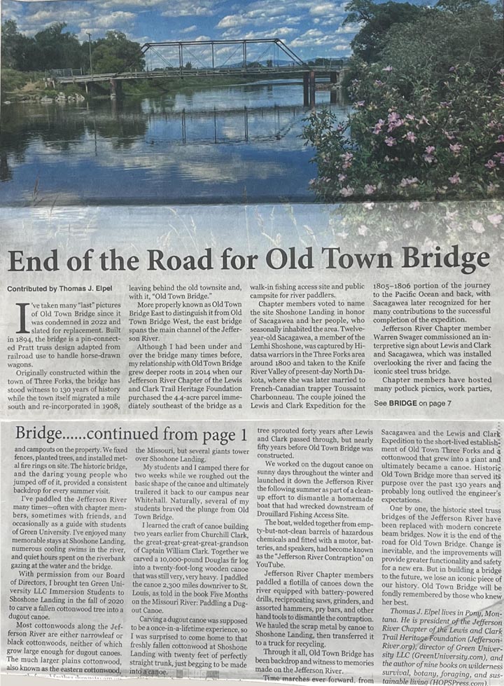
End of the Road for Old Town Bridge (Newspaper Article)
Jefferson River Chapter LCTA
PO Box 697
Pony, MT 59747
Contact Us
Become a Member
Join us today!

 Jefferson River Chapter Membership: Join us Today!